
by Christine Lorraine Morgan, March, 2026
Looking back to when Erie was a fledgling town, it was composed of small communities such as Federal Hill, Jerusalem, Cloughsburg and Kingtown.
Another place that sprang up in Erie’s early days was named Stumptown.
This area extended from around West 4th and Peach to the bayfront, then west to Sassafras and south to 4th Street.
It earned this name because it was a place where navy personnel, lumber workers and shipbuilders resided, beginning in January 1814. Even though the Battle of Lake Erie took place in September 1813, the War of 1812 did not end until 1815.
And throughout that time, those who dwelled in Erie lived in fear that they would look out over the bay one day and see British ships approaching.
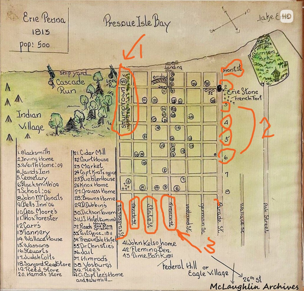
Lee’s run was located near the foot of Sassafras to the west, based on this 1813 hand-drawn map. Stumptown (#1) was, according to the Hagen History Center website, “…near the mouth of Lee’s Run and became populated with people working on the ships during the building of Perry’s fleet.”
#2 on the map shows the city streets with numbered names, Front, 2nd, 3rd St., etc. #3 has encircled French, State, Peach and Sassafras Streets.
January and February are generally brutally cold in Erie, especially near the bayfront, and these people needed places to live quickly. Providing housing to the shipbuilders, military personnel and lumber workers was something that needed to taken care of ASAP.
Twenty years later, after Stumptown was long gone, “Lee’s Run disappeared from local maps when the Erie Extension Canal used the creek-bed through the city to become the route for the canal connecting Erie with Pittsburgh in 1844,” according to https://www.hagenhistory.org/blog/long-life-and-happiness-for-all-its-residents-50
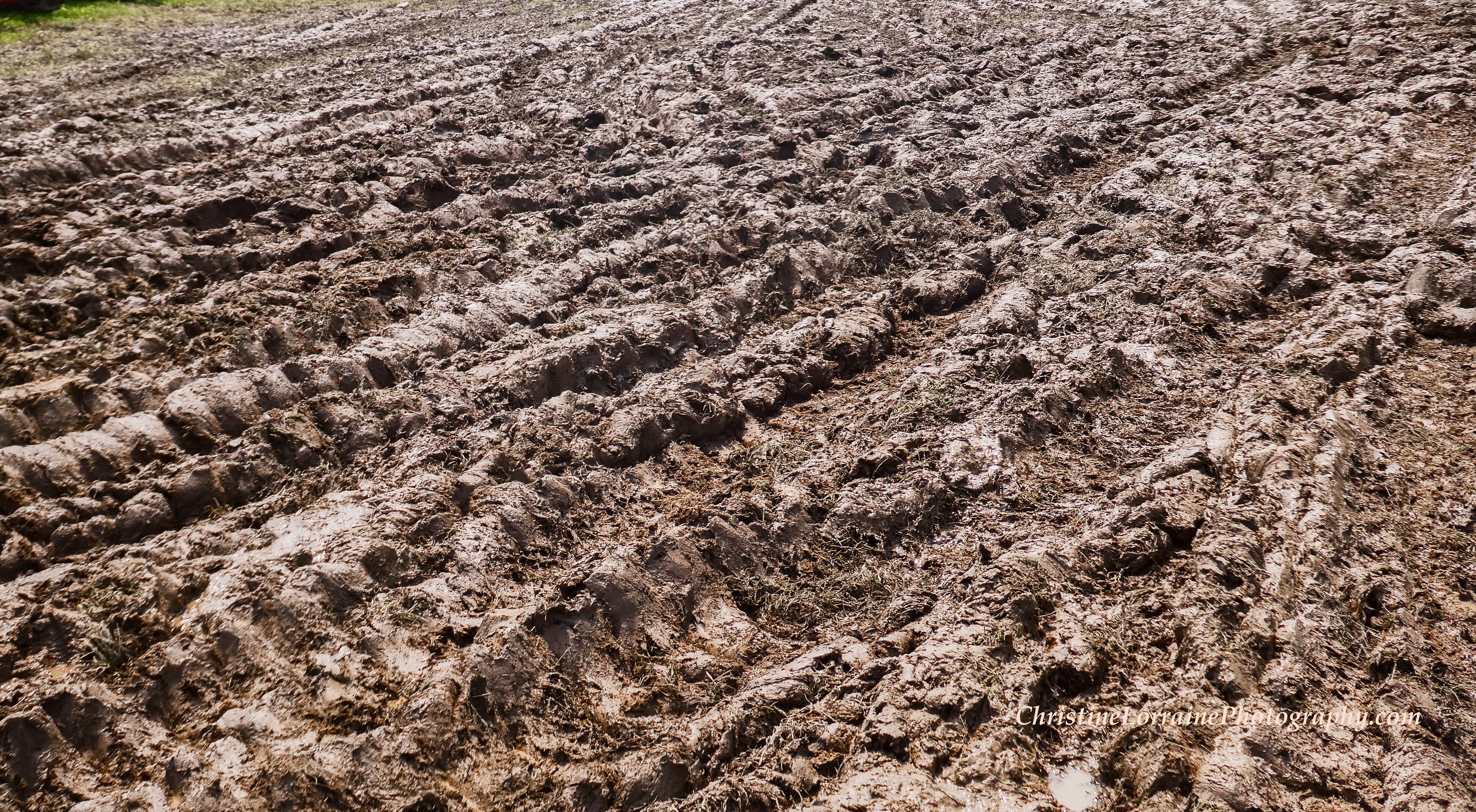
So next time you’re in the vicinity of 4th and Peach or Sassafras, try to visualize north Erie when it was plagued with muddy roads, a lack of housing, and hundreds of stumps that lined the narrow dirt paths that would one day become the city streets upon which we drive.
Also contemplate if a commemorative marker should be designated for Stumptown in this historically-rich section of Erie, which was critical to Erie’s role in the War of 1812?
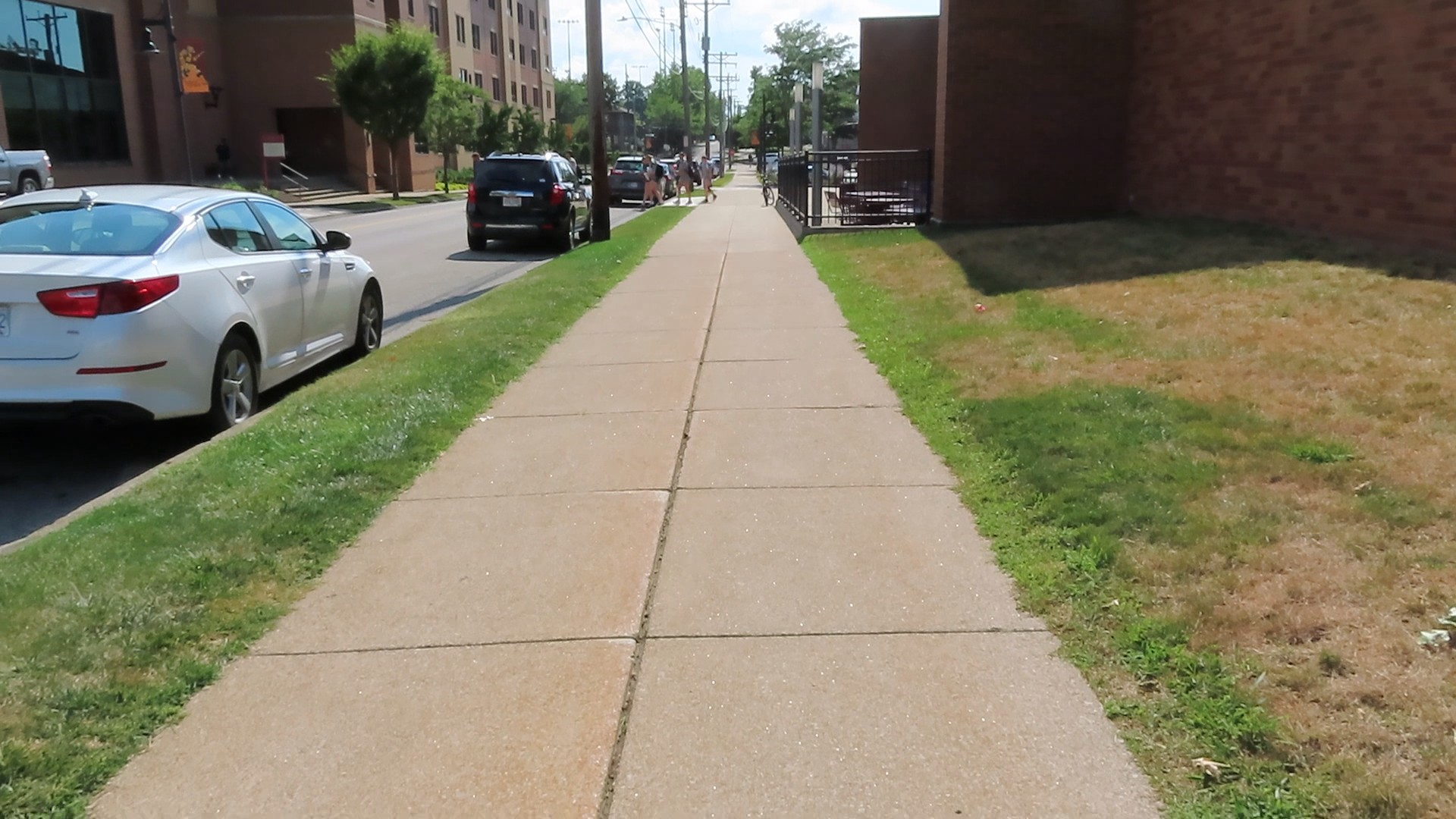
The area of Stumptown looks like this today. Image capture August 2025

