
by Christine Lorraine Morgan, March 27, 2026
When the town of Erie, PA was growing into the fair city that it is today, it was composed of a handful of neighborhoods with individual names and locations. Here are the nine that were discovered, then researched through local history books and newspaper clippings.
Bringing Erie’s Nine “forgotten” communities into the spotlight for a revival. Each of these areas should have a historical marker if they don’t already have one.
Early Erie Communities
1. Cloughsburg ~ 6th and Parade streets, SW corner. This settlement was named for Rufus Clough, who opened a grocery store and blacksmith operation. A small community of settlers lived there around him, considering how convenient it was to live near a spot where they could get their horses shoed, and obtain provisions to boot.
“In the early 1800s, this neighborhood was very popular with early settlers as it was located on the ‘Old French Road’ that went from the area of the fort through the wilderness to Waterford,” according to hagenhistory. org
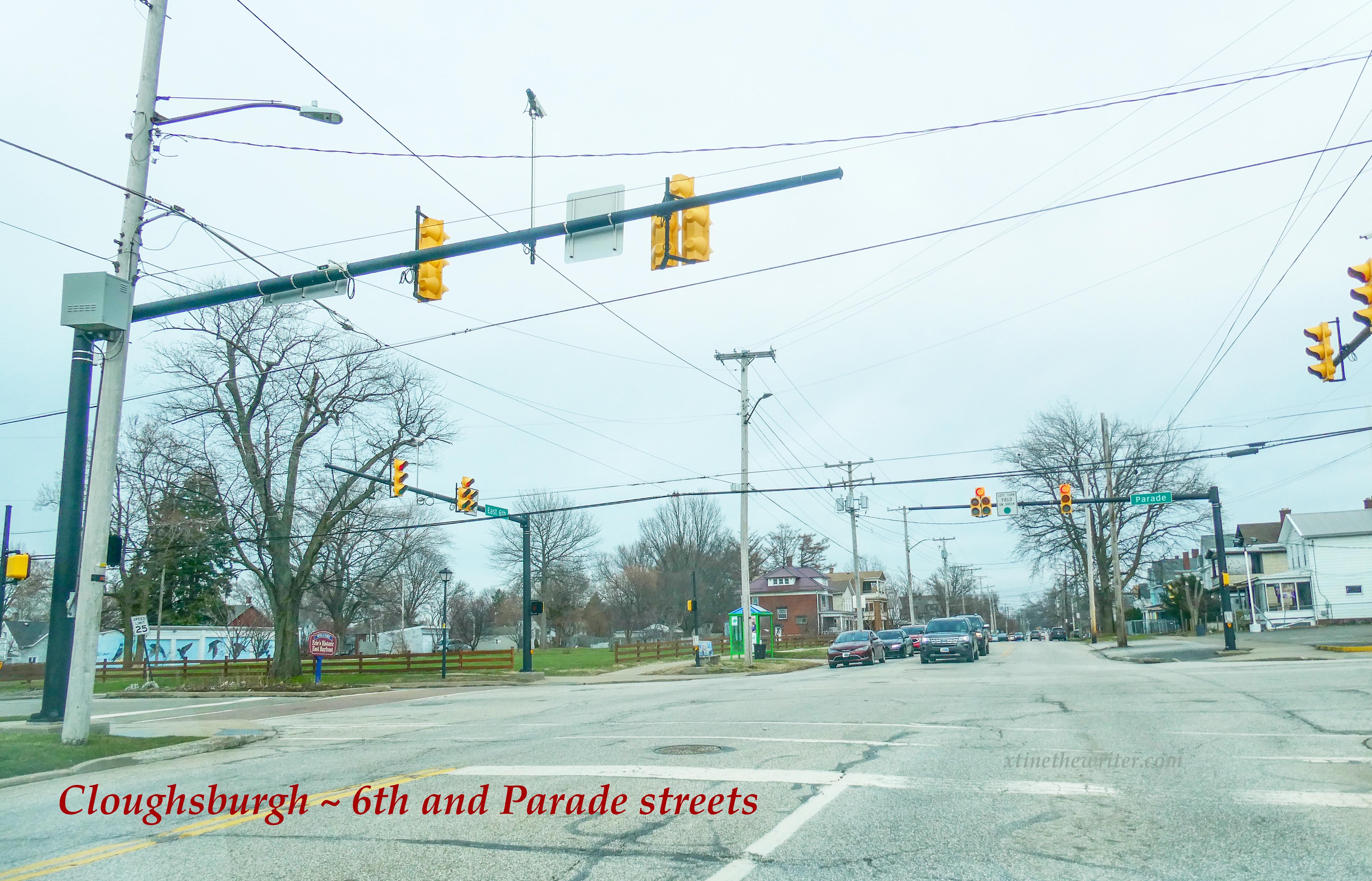
Cloughsburg ~ this shows the intersection of E. 6th and Parade streets
2. Federal Hill/Eagle Village ~ Considered to be at the summit of the ridge at Peach and W. 26th streets, the name of this local neighborhood is credited to George Moore due to the Federalists who resided in that area. Considering it was the terminus of the Ridge Road and Waterford Pike Road, several public houses had sprung up there as early as 1812. One of these places was named the American Eagle, thus the neighborhood was known as Eagle Village. Federal Hill has undergone a revival of sorts in recent years, and the people in Erie have begun to embrace the historic name of this 200+ year-old village.
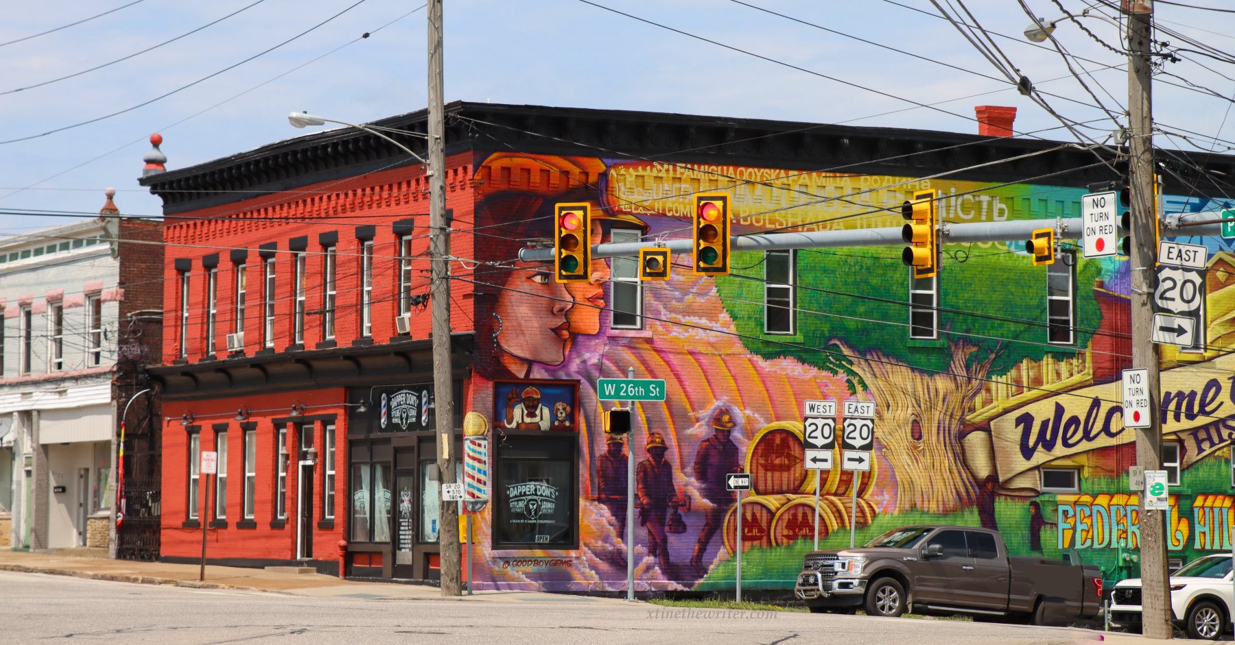
Federal Hill, on the NE corner of W. 26th St. (Route 20) and Peach St. (Route 19)
3. Kingtown ~ Alfred King laid out this community approximately in the vicinity of East 3rd to East 7th, and Ash to Wayne streets. It is said that older residents of the 5th and East Avenue area continued to refer to that neighborhood as Kingtown into the mid-20th century. Wonder if anyone still does.
View of an area of Kingtown
4. Marvintown ~ “Marvintown was the home of Elisha Marvin, who lived at the Sennett place, near the junction of Parade street and the Wattsburg road, had splendid grounds, and owned most of the land around. Being the intersection of two roads, a small village sprang into existence, and in 1852-53 Mr. Marvin employed Samuel Low to lay out the land in lots. The lots were sold principally to Germans, and finally Mr. Marvin disposed of his home to Mr. Sennett,” according to rootsweb. com This section of Erie has recently begin to receive recognition as being Marvintown, a very historic part of the City’s development.
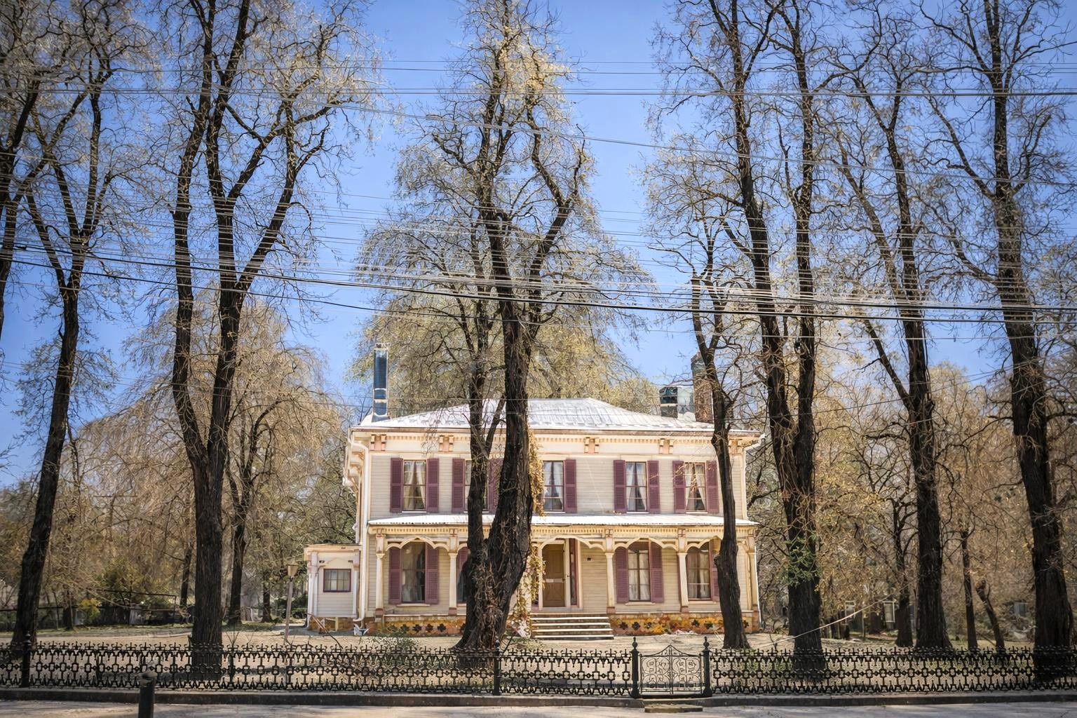
The Marvintown Homestead as it appeared before being torn down as the area of E. 28th and Pine and Old French Road was built up over the years.
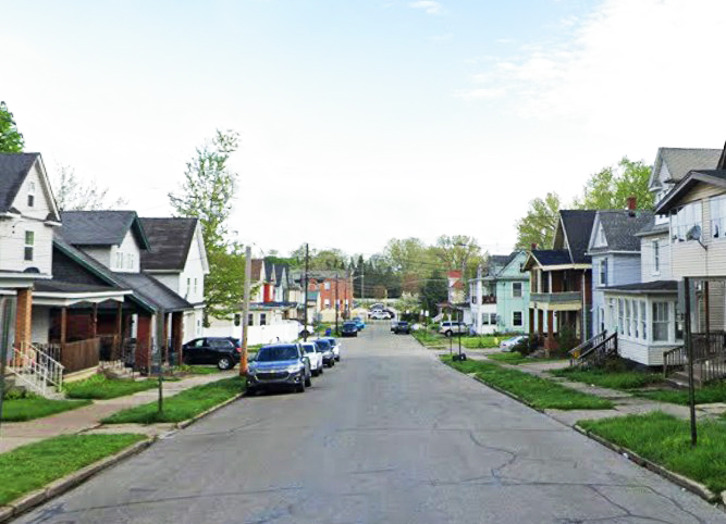
5. New Jerusalem ~ This community encompassed the land north of W. 6th Street, west of Sassafras. It was named by the man who purchased that tract of land, Mr. Himrod, who resided at 2nd and French. It is said that Himrod referred to his home as “Jericho,” and because the new tract was challenging to get to, the road leading to it was called the road from Jericho to Jerusalem. Older residents of the neighborhood around Gridley school supposedly continued to call the area New Jerusalem into the mid-20th century.
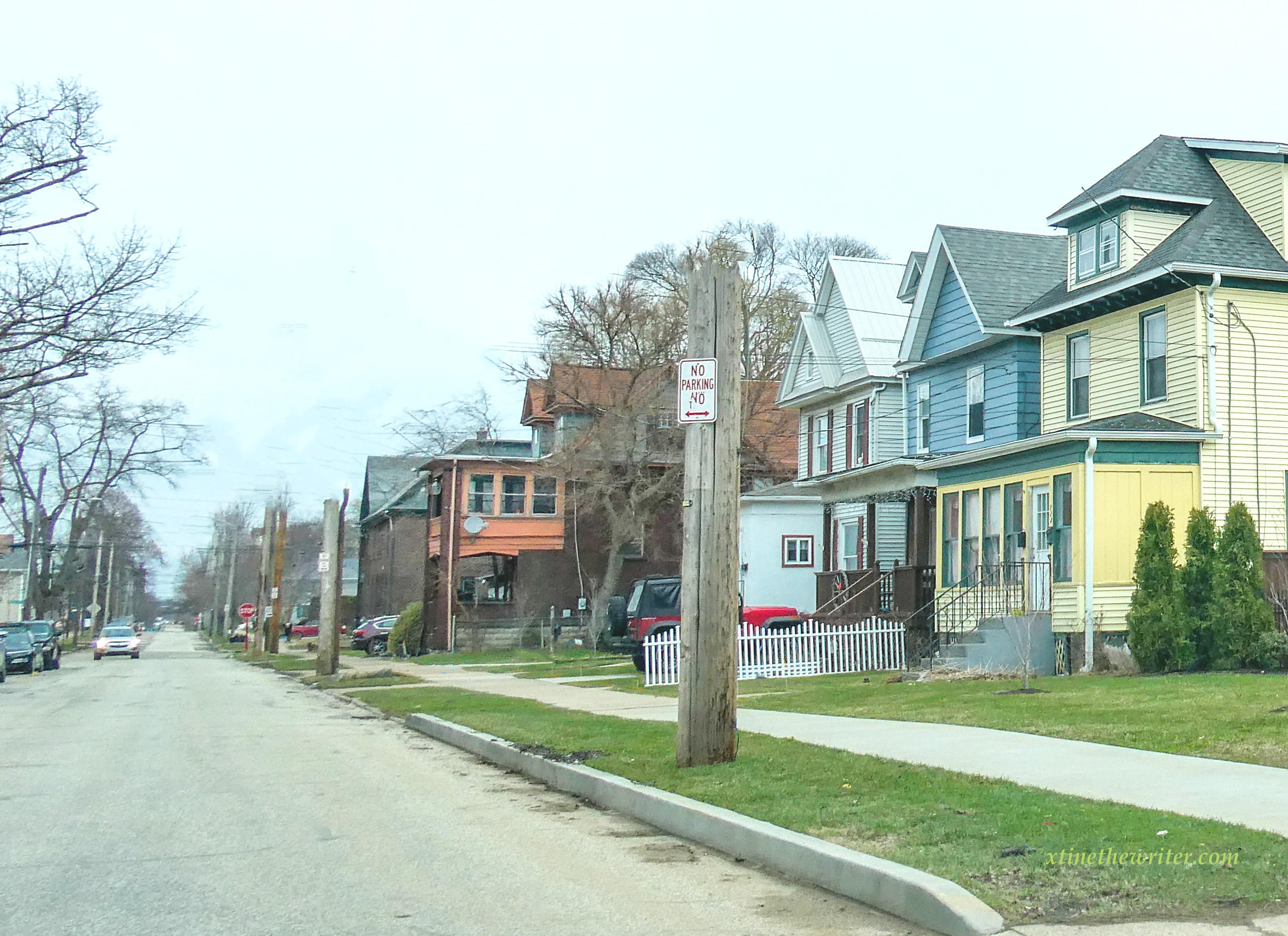
Here’s a 2026 glimpse of a street what was located in the New Jerusalem neighborhood.
6. South Erie ~ Here is a borough which came into being due to the construction of the Lake Shore Railroad, which was completed in 1852. South Erie was incorporated as a borough in 1866 and became part of the City of Erie by the extension of city borders in 1870. South Erie covered the approximate area from West 18th to 26th, and from Parade to Cherry streets, as explained at hagenhistory. org.
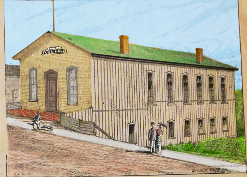
This 1888 sketch from Erie, Penn’a Illustrated shows the original South Erie Turners building, around which the club that exists today was built.
7. Stumptown ~ This area of historic Erie earned its name due to the large amount of tree stumps left in the wake of building houses for shipbuilders, military personnel and lumber workers. During the War of 1812, which did not conclude until 1815, housing was urgently needed here so trees were cut and land was cleared for a military encampment in January 1814. Stumptown ran from Peach to Sassafras, from the bayfront to about 4th Street. This is another area of old Erie that is presently undergoing newfound recognition, perhaps a historic marker can be placed there one day.
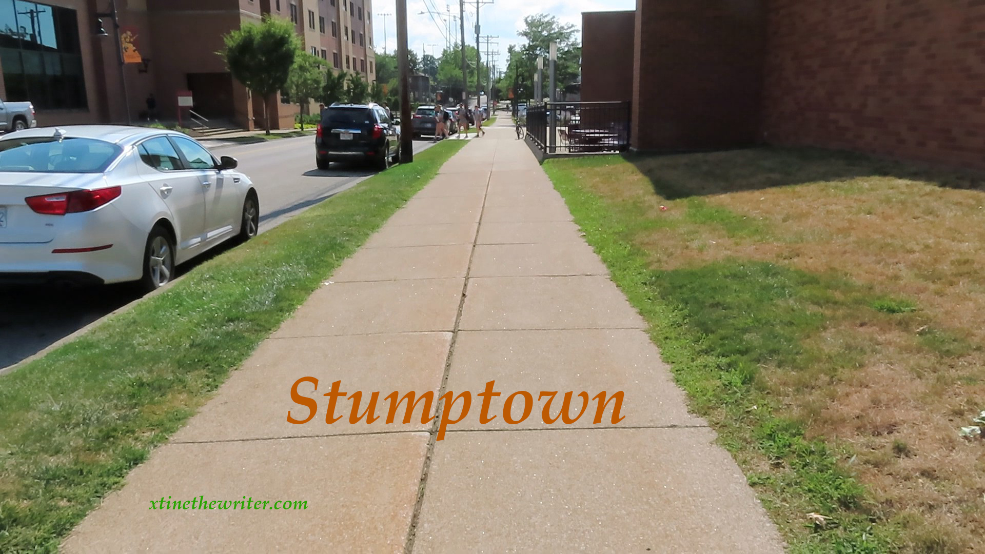
This view of Stumptown from early Erie shows West 4th Street between Sassafras and Peach streets, which was the southern border of that area.
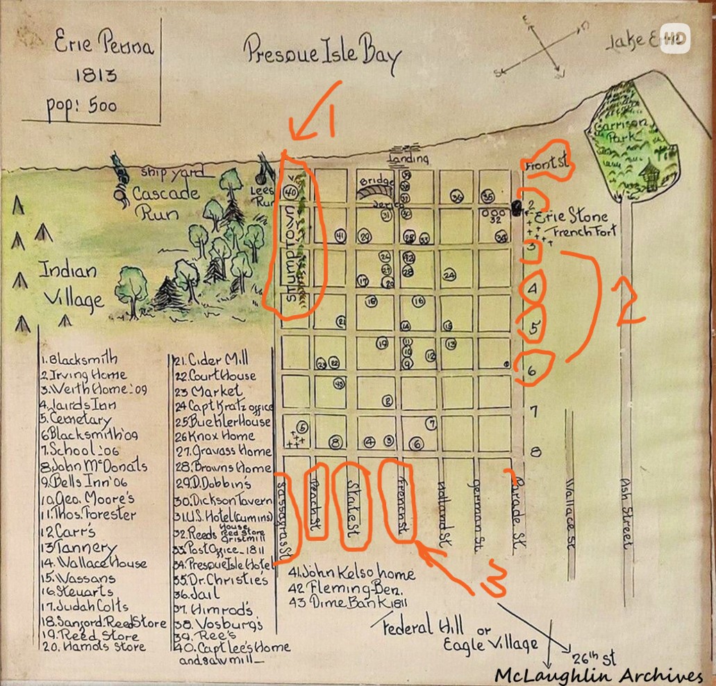
The map below from the McLaughlin Archives shows the area in which Stumptown was situated. #1 points to Stumptown, 2 shows East-to-West running numbered streets, 3 points to North-South named streets.
8. Warfeltown ~ Laid out by M. Warfel in the southeast section of Erie along the Philadelphia and Erie Railroad. Martin Warfel’s farm was situated between East Avenue and Elm Street, and from around East 18th to East 28th streets. Warfel worked for the firm of Swalley and Warfel, which had a Peach Street factory which produced soaps and laundry products in the mid-1800s. Prior to being dubbed Warfeltown, this area is known to have been a massive native American burial site, possibly was the location of a city of Erie Indians named Rique.
9. Weigeltown/Weigelville ~ A busy area for travelers coming into and exiting the City of Erie, this outer limits community was named for German pioneer George Weigel Senior. In 1833 he bought 50 acres the vicinity of W. 26th and Brown Avenue, which was in Mill Creek Township at the time. The Weigelville Inn opened just west of that intersection and provided a spot for stagecoaches, farmers and other travelers on their way to the big city a mile-and-a-half to the north. It is said that the Inn was known to make provisions for incoming herds, which were put up in the drove-yard while the workers may have tipped a glass or two at the tavern.
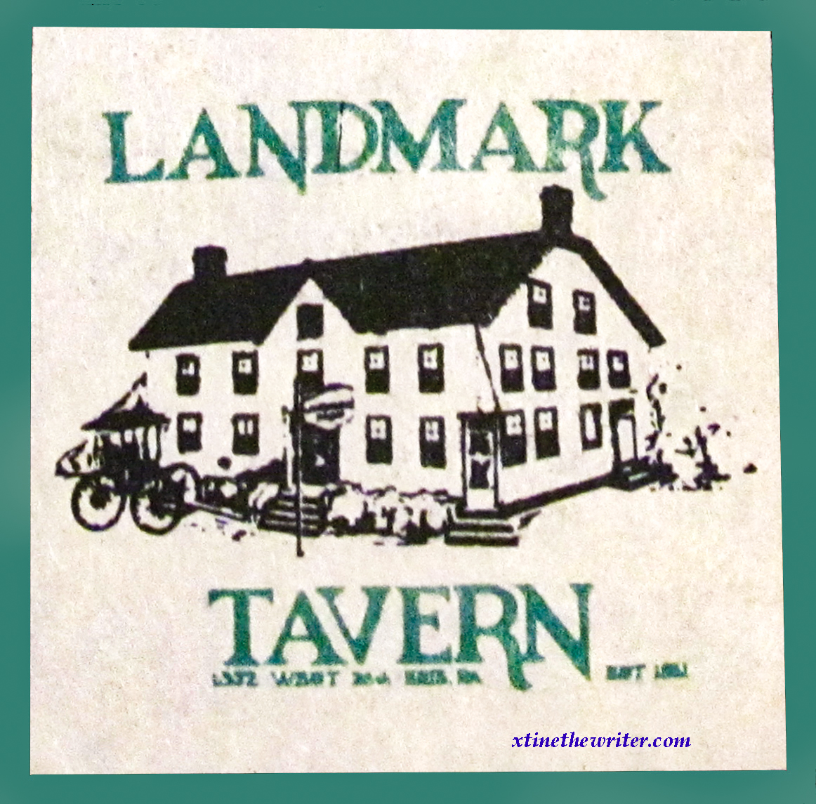
The Landmark Tavern was situated in Weigelville in the 1300 block of W. 26th Street into the 1990s.
Some pictures were contributed by GC68/Toby

